
NASA and SpaceX Launch US-European Satellite to Monitor Earth’s Oceans


About the size of a full-size pickup truck, a newly launched satellite by NASA and its partners will provide ocean and atmospheric information to improve hurricane forecasts, help protect infrastructure, and benefit commercial activities, such as shipping.
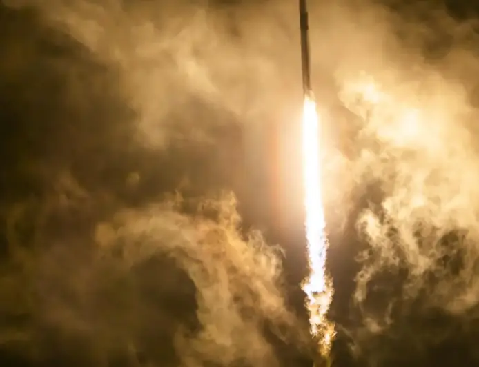
The Sentinel-6B satellite lifted off aboard a SpaceX Falcon 9 rocket from Launch Complex 4 East at Vandenberg Space Force Base in central California at 9:21 p.m. PST on Nov. 16. Contact between the satellite and a ground station in northern Canada occurred about 1 hour and 30 minutes later at 10:54 p.m. All systems are functioning normally.
“Understanding tidal patterns down to the inch is critical in protecting how we use our oceans every day on Earth,” said Nicky Fox, associate administrator, Science Mission Directorate at NASA Headquarters in Washington. “Sentinel-6B will build upon the legacy of Sentinel-6 Michael Freilich by making sea level measurements that improve forecasts used by communities, businesses, and operations across the country. It also will support a safer reentry for our astronauts returning home, including crew from Artemis Moon missions.”
Sea levels vary from place to place, and the satellite will provide accurate measurements at both local and global scales — all from hundreds of miles above in low Earth orbit. Those observations form the basis for U.S. flood predictions, which are crucial for safeguarding coastal infrastructure, real estate, energy storage sites, and other coastal assets. Sentinel-6B will take over for Sentinel-6 Michael Freilich, which launched in 2020 and later became the official reference satellite for global sea level measurements, providing sea surface height measurements against which those from other satellites are compared for accuracy.
The satellite comes from a collaboration between multiple partners, including NASA, ESA (European Space Agency), EUMETSAT (European Organisation for the Exploitation of Meteorological Satellites), and the National Oceanic and Atmospheric Administration (NOAA). It also is part of the European Union’s family of Copernicus missions.
Reward this post with your reaction or TipDrop:
 Like
0
Like
0
 Dislike
0
Dislike
0
 Love
0
Love
0
 Funny
0
Funny
0
 Angry
0
Angry
0
 Sad
0
Sad
0
 TipDrop
0
TipDrop
0